Knihy od autora Mapseeker Publishing Ltd.
Zobrazeno 1 – 20 z 22 výsledků
-
Bradshaw's Railway Map Central Europe 1913
George Bradshaw, Mapseeker Publishing Ltd. | Historical Images Ltd, 2013
50 % šance - Prohledáme celý světJazyk: Angličtina
Vazba: Mapa
561 Kč
-

Samuel Bradford Town Plan Birmingham 1750
Samuel Bradford, Mapseeker Publishing Ltd. | Historical Images Ltd, 2013
Skladem u dodavatele - Odesíláme za 3-5 dnůJazyk: Angličtina
Vazba: Mapa
743 Kč
-
Collection of Four Historic Maps of Cambridgeshire from 1611-1836
Mapseeker Publishing Ltd. | Historical Images Ltd, 2013
Skladem u dodavatele - Odesíláme za 3-5 dnůJazyk: Angličtina
Vazba: Mapa
743 Kč
-
Collection of Four Historic Maps of Kent from 1611-1836
Mapseeker Publishing Ltd. | Historical Images Ltd, 2014
Skladem u dodavatele - Odesíláme za 3-5 dnůJazyk: Angličtina
Vazba: Mapa
743 Kč
-
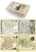
Essex 1610 - 1836 - Fold Up Map that features a collection of Four Historic Maps, John Speed's County Map 1610, Johan Blaeu's County Map of 1648, Thom
Mapseeker Publishing Ltd. | Historical Images Ltd, 2014
50 % šance - Prohledáme celý světJazyk: Angličtina
Vazba: Mapa
743 Kč
-

James Drake's Street Plan and Index of Birmingham 1832
James Drake, Mapseeker Publishing Ltd. | Historical Images Ltd, 2013
50 % šance - Prohledáme celý světJazyk: Angličtina
Vazba: Mapa
743 Kč
-
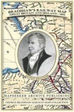
Bradshaw's Railway Map Great Britain and Ireland 1852
George Bradshaw, Mapseeker Publishing Ltd. | Historical Images Ltd, 2013
Skladem u dodavatele - Odesíláme za 3-5 dnůJazyk: Angličtina
Vazba: Mapa
743 Kč
-
Collection of Four Historic Maps of Liverpool from 1785-1903
Mapseeker Publishing Ltd. | Historical Images Ltd, 2014
Skladem u dodavatele - Odesíláme za 3-5 dnůJazyk: Angličtina
Vazba: Mapa
743 Kč
-
Cornwall 1611 - 1836 - Fold Up Map that features a collection of Four Historic Maps, John Speed's County Map 1611, Johan Blaeu's County Map of 1648, T
Mapseeker Publishing Ltd. | Historical Images Ltd, 2014
50 % šance - Prohledáme celý světJazyk: Angličtina
Vazba: Mapa
743 Kč
-
Derbyshire 1610 - 1836 - Fold Up Map that features a collection of Four Historic Maps, John Speed's County Map 1611, Johan Blaeu's County Map of 1648,
Mapseeker Publishing Ltd. | Historical Images Ltd, 2014
Skladem u dodavatele - Odesíláme za 3-5 dnůJazyk: Angličtina
Vazba: Mapa
743 Kč
-
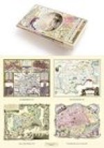
Middlesex 1611 - 1836 - Fold Up Map that features a collection of Four Historic Maps, John Speed's County Map 1611, Johan Blaeu's County Map of 1648,
Mapseeker Publishing Ltd. | Historical Images Ltd, 2019
Skladem u dodavatele - Odesíláme za 3-5 dnůJazyk: Angličtina
Vazba: Brožovaná
743 Kč
-
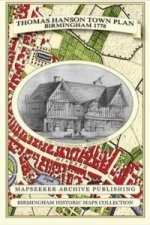
Thomas Hanson Town Plan of Birmingham 1778
Thomas Hanson, Mapseeker Publishing Ltd. | Historical Images Ltd, 2013
50 % šance - Prohledáme celý světJazyk: Angličtina
Vazba: Mapa
743 Kč
-
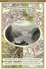
Collection of Four Historic Maps of Bristol from 1851-1903
Mapseeker Publishing Ltd. | Historical Images Ltd, 2013
Skladem u dodavatele - Odesíláme za 3-5 dnůJazyk: Angličtina
Vazba: Mapa
743 Kč
-

Devon 1611 - 1836 - Fold Up Map that features a collection of Four Historic Maps, John Speed's County Map 1611, Johan Blaeu's County Map of 1648, Thom
Mapseeker Publishing Ltd. | Historical Images Ltd, 2014
Skladem u dodavatele - Odesíláme za 3-5 dnůJazyk: Angličtina
Vazba: Mapa
743 Kč
-
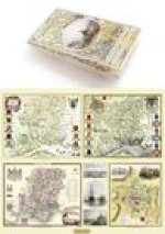
Hampshire 1610 - 1836 - Fold Up Map that features a collection of Four Historic Maps, John Speed's County Map 1611, Johan Blaeu's County Map of 1648,
Mapseeker Publishing Ltd. | Historical Images Ltd, 2014
50 % šance - Prohledáme celý světJazyk: Angličtina
Vazba: Mapa
743 Kč
-

Old Map of Wednesbury 1846
Mapseeker Publishing Ltd., Plansearch UK | Historical Images Ltd, 2012
50 % šance - Prohledáme celý světJazyk: Angličtina
Vazba: Mapa
488 Kč
-
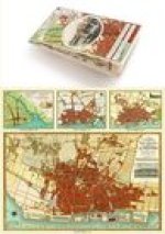
Liverpool 1650 to 1821 - Fold Up Map Containing Town Plans of Liverpool that include Liverpool 1650, 1725, 1795 and Sherwood's plan of Liverpool and E
Mapseeker Publishing Ltd. | Historical Images Ltd, 2014
50 % šance - Prohledáme celý světJazyk: Angličtina
Vazba: Mapa
743 Kč
-
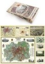
Manchester 1650 - 1876 - Fold Up Map featuring William Swire's Plan of Manchester and Environs 1824, Cole and Ropers Plan of Manchester and Salford 18
Mapseeker Publishing Ltd. | Historical Images Ltd, 2014
50 % šance - Prohledáme celý světJazyk: Angličtina
Vazba: Mapa
743 Kč
-
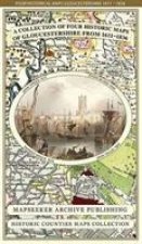
Gloucestershire 1611 - 1836 - Fold Up Map that features a collection of Four Historic Maps, John Speed's County Map 1611, Johan Blaeu's County Map of
Mapseeker Publishing Ltd. | Historical Images Ltd, 2014
Skladem u dodavatele - Odesíláme za 3-5 dnůJazyk: Angličtina
Vazba: Mapa
743 Kč
-
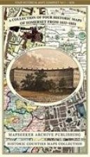
Collection of Four Historic Maps of Somerset from 1611-1851
Mapseeker Publishing Ltd. | Historical Images Ltd, 2014
Skladem u dodavatele - Odesíláme za 3-5 dnůJazyk: Angličtina
Vazba: Mapa
743 Kč

Knihy vám rádi za malý poplatek dárkově zabalíme. Zjistěte více
Filtrovat výsledky
Osobní odběr Praha, Brno a 12903 dalších
Copyright ©2008-24 nejlevnejsi-knihy.cz Všechna práva vyhrazenaSoukromíCookies
 Vrácení do měsíce
 571 999 099 (8-15.30h)